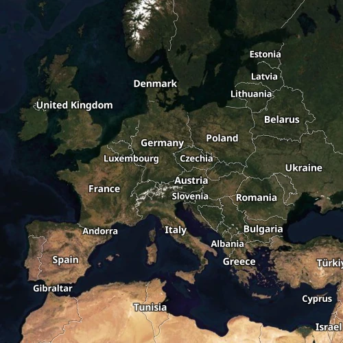
Satellite Plain and Hybrid maps
High resolution satellite & aerial imagery serving as a backdrop map or packaged with streets & placenames for context in the Hybrid style.

Plain & Hybrid
Satellite Plain showcases the raw beauty of aerial imagery, whereas Satellite Hybrid adds context by overlaying labels, roads, and borders.
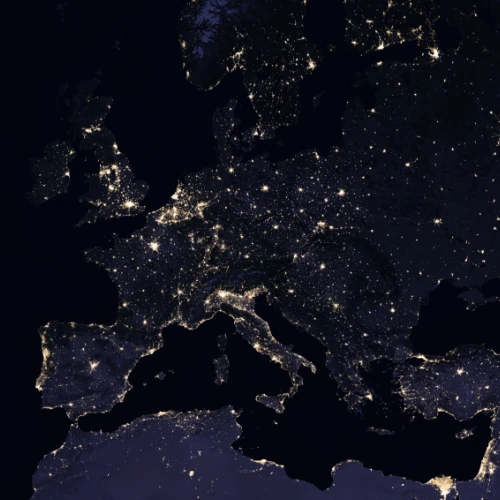
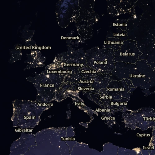
Dark mode
The Dark variant combines night satellite data with dimmed aerial imagery, providing the perfect backdrop in low-light environments.
Easy publishing
Seamlessly share and embed interactive maps in your applications and dashboards.
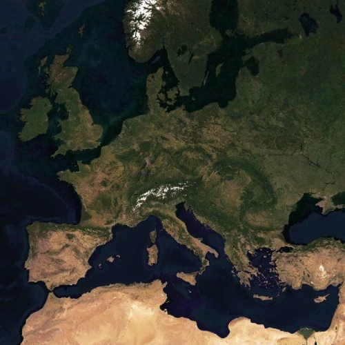
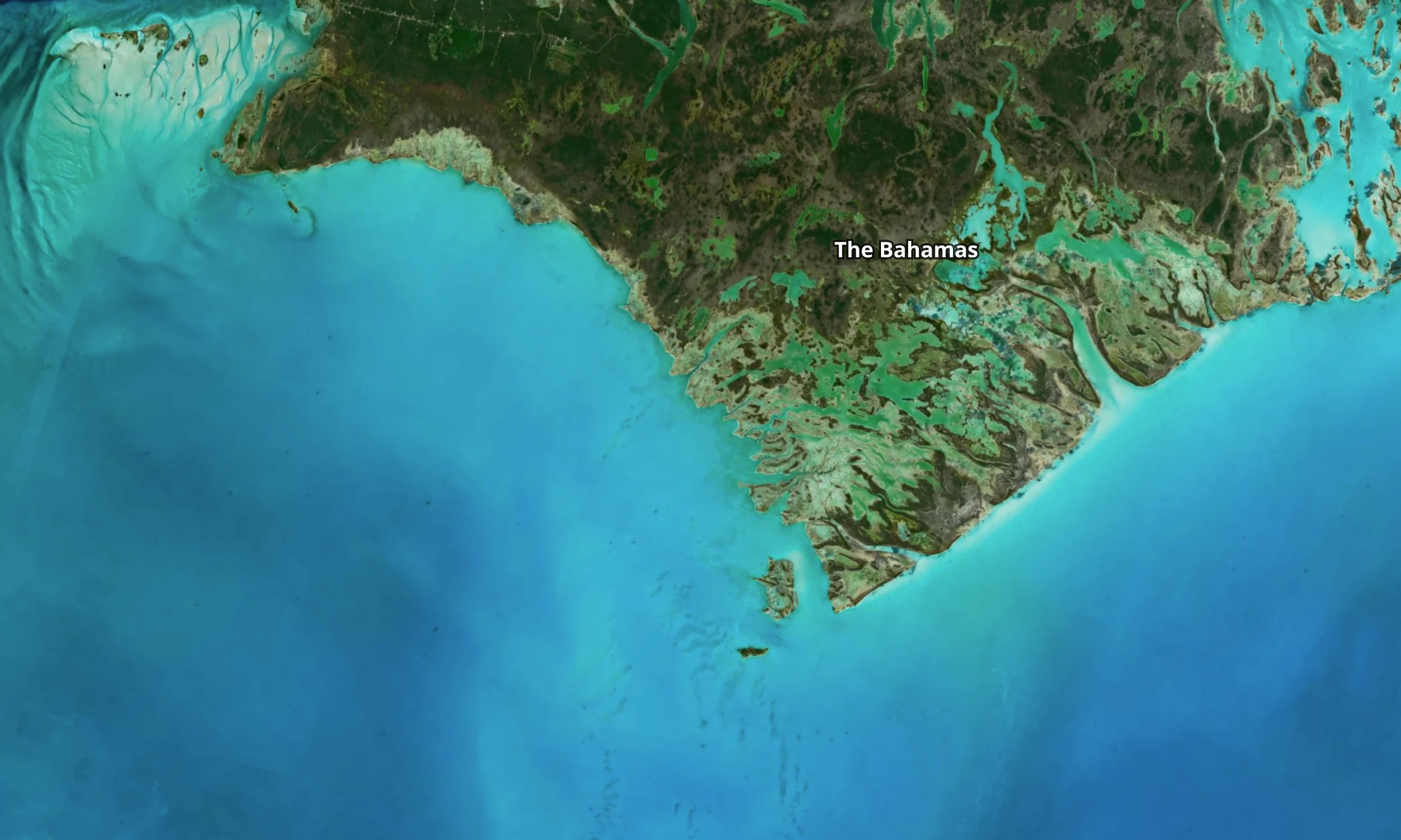
Global high-resolution coverage
Cloudless global coverage at 2m per pixel, color balanced by our expert cartographers to provide a beautiful backdrop.
Detailed imagery that zooms and pans seamlessly everywhere.
Regularly updated to provide the most recent satellite view of the entire world.
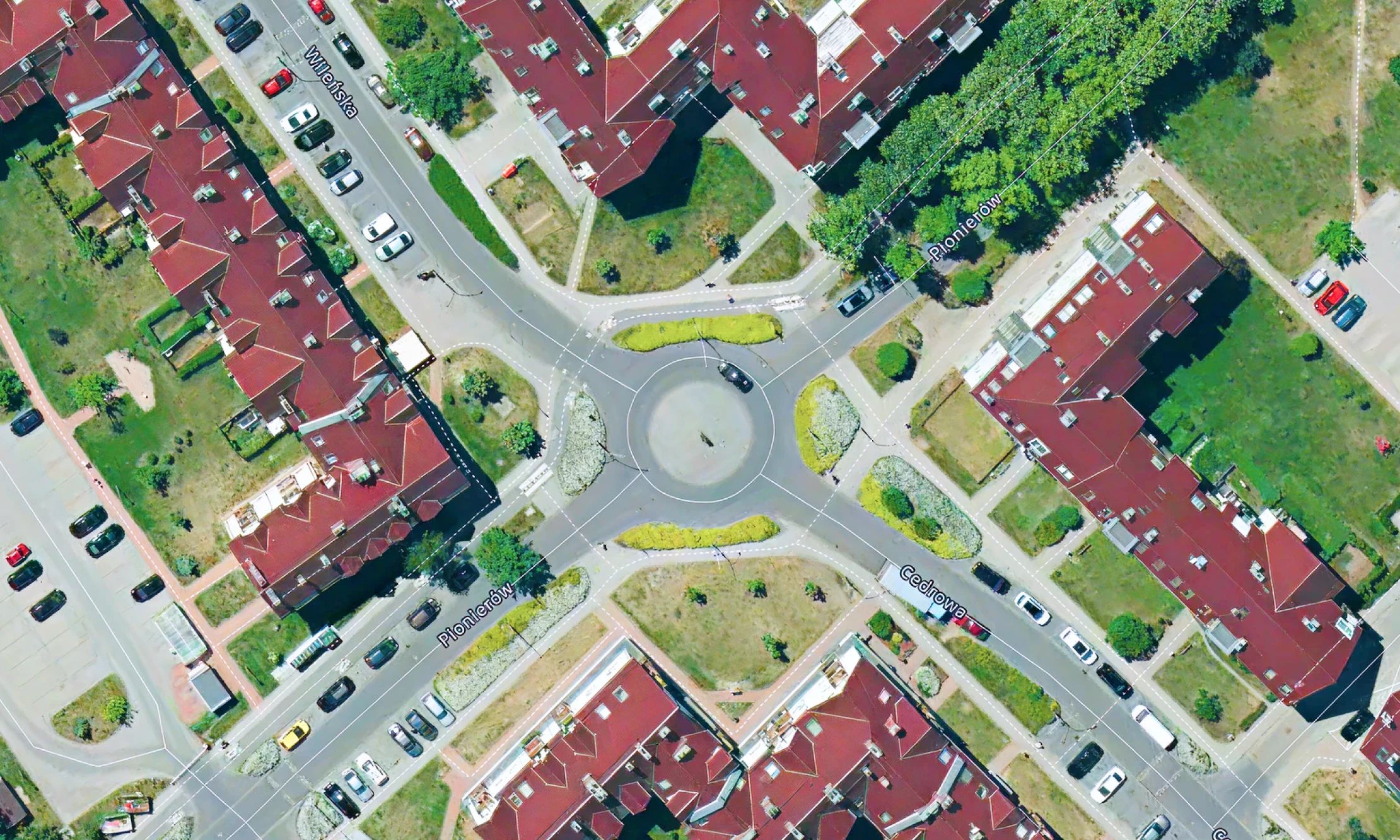
Detailed aerial imagery for navigation
Show individual streets in great detail (up to 8cm per pixel), helping your users find locations easily on fresh aerial imagery.
See neighbourhoods, shopping centres, and other areas as they appear in real life, assisting in decisions like where to live or locate a business.
Available as:


Publish anywhere
Use maps on your website and apps, either from our cloud or your on-prem solution.